![]()
Our MapShapes have been very popular since we introduced them in 2008. Now that we’ve posted two articles on how to use Visimation MapShapes to create maps and visualize data, I just want to summarize by responding to 5 most frequently asked questions we’ve received about MapShapes. I hope this information helps you to determine if MapShapes will be valuable to you in your work:
What versions of MapShapes are available and what versions of Visio are supported?
 We currently offer MapShapes …Continue reading
 While it’s useful just to view geographic maps in Visio, the information becomes even more valuable when linked to data in Visio 2007. We’ll show you how to do this using Visimation MapShapes and you can use similar techniques to link data with any Visio 2007 diagram.
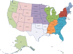
 Map of United States grouped by US Census Region